 These images appear as a double-page spread at the beginning of G. Woolworth Colton, Colton's General Atlas (New York: G.W. & C.B. Colton, 1866). The graphics at the top represent the world's major rivers, arranged from longest to shortest; the graphics at the bottom represent the world's mountains and volcanoes (with tongues of flame), from lowest to highest. The two sets of graphics information form a diagonal shape, giving an attractive sense of proportion as they bring these difficult-to-comprehend numbers to life. Courtesy Maps Collection, University of California, Santa Cruz. 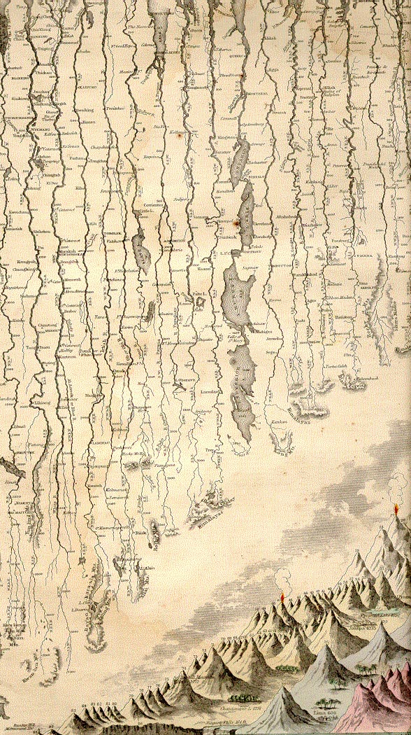
|